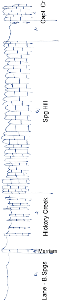
KGS Home

Geology Index Page

Wilson County

Sec. 7, T. 30 S., R. 16 E
Move to another county

Measured By Newell, 8/1938
Unit No. Description Thickness
1 Limestone, white, xln, remnant  
2 Shale, gray, poorly shown, contains algal limestone near top 11.5 ft.
3 Limestone, white, xln, less shaly above, yellow below with fossililiferous shale breaks; top bed oolitic 83 ft.
4 Shale, gray and buff, calcareous, contains abundant sponges & crinoid stems +/- 30 ft.
5 Limestone, yellow, irregular, crinoidal 1.5 ft.
6 Shale, buff, silty, unfossiliferous  

Original Document

The Archive file you download contains a TIFF image compressed into a ZIP archive. Your browser may be already set up to decompress these files. Commercial software to perform this is available from PKWARE, Inc., the company that invented the format. A web page from a group of people creating shareware or public domain software is available at Info-ZIP. The TIFFs are 150-dpi archival-quality color scans of the original forms and can be viewed by software like Corel PhotoPaint or Adobe PhotoShop.


Kansas Geological Survey
Comments to webadmin@kgs.ku.edu
URL=http://www.kgs.ku.edu/General/Geology/Measured/index.html
Programs Updated May 2003