|
|
||
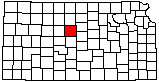
Data from Russell County |
||
| Water Databases | |
|---|---|
| WWC5 | The Water Well Completion Records database contains information from records submitted by water well drillers to the Kansas Department of Health and Environment. There are 1742 records for Russell County. |
| Wizard | The Wizard database contains water level information for many wells in Kansas. |
| WIMAS | WIMAS is a web based application that allows users to query, analyze, and map Kansas water right data. Data is retrieved daily from the Kansas Department of Agriculture's, Division of Water Resources Water Rights Information System. |
| Other Databases | |
| Industrial Minerals | View active and inactive quarries. |
| Bibliography | Created by the KGS, the bibliography lists all publications from all sources concerning the geology and hydrology of Kansas. |
| Photo Library | A selection of Kansas photos from our files. |
| Measured Sections | Descriptions of outcrops (limited availabilty). |
| Web sites and pages | |
|
Geologic Map: Web version of Russell County geologic map
Bulletin: Surficial geology and stratigraphy of Russell County, Kansas Bulletin: The Geology of Russell County, Kansas, with special reference to Oil and Gas Resources
These next links present resources outside of the Kansas Geological Survey. |
|