|
|
|
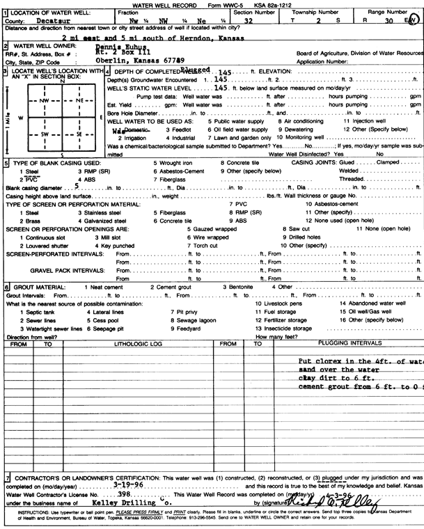
Specific Water Well Detail |
|
|
| Location Info | |||
| Owner: Euhus, Dennis | Status: Plugged | ||
| Location: T2S, R30W, Sec. 32, NW NW NE | County: Decatur | ||
| Directions: from Herndon, 2 mi E and 5 mi S | |||
| Latitude: 39.8418598 | Longitude: -100.7110246 | Datum NAD 27 | |
| Latitude: 39.841864 | Longitude: -100.7114524 | Datum NAD 83 | |
| Longitude and latitude calculated by Survey from township-range-section-quarter calls. Only good to within the quarter call accuracy. | |||
| View well on interactive map | |||
| General Info | ||
| Well Depth: 145 ft. | Elevation: ft. | |
| Static Water Level: ft. | Est. Yield: gpm. | |
| Comp. Date: 19-Mar-1996 | Well Use: Domestic | |
| DWR Applic. #: | Other ID: | |
| Driller Info | ||
| Driller: Richard O. Kelley Drilling Co. | License #: 398 | |
| Scanned Form | View scan |
| Casing Info | ||
|
Casing Type: Steel
Diam: 5 in. Casing height above land surface: in | ||
| Grout Info | ||
| Grout used: Cement grout | From: 6 to 0 ft
From: 0 to 0 ft From: 0 to 0 ft | |
| Source of Possible Contamination | ||
| Source: | ||
| Direction from well: | Distance: 0 ft | |