|
|
|
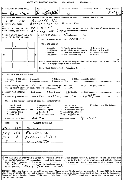
Specific Water Well Detail |
|
|
| Location Info | |||
| Owner: Claude Kisling Farms | Status: Plugged | ||
| Location: T1S, R34W, Sec. 10, SW NE NW | County: Rawlins | ||
| Directions: from Atwood, 11 mi N and 4 mi W | |||
| Latitude: 39.9847682 | Longitude: -101.1242669 | Datum NAD 27 | |
| Latitude: 39.9847685 | Longitude: -101.1247043 | Datum NAD 83 | |
| Longitude and latitude calculated by Survey from township-range-section-quarter calls. Only good to within the quarter call accuracy. | |||
| View well on interactive map | |||
| General Info | ||
| Well Depth: 190 ft. | Elevation: ft. | |
| Static Water Level: ft. | Est. Yield: gpm. | |
| Comp. Date: 22-May-1996 | Well Use: Domestic | |
| DWR Applic. #: | Other ID: | |
| Driller Info | ||
| Driller: well owner | License #: | |
| Scanned Form | View scan |
| Casing Info | ||
|
Casing Type: Steel
Diam: 5 in. Casing height above land surface: in | ||
| Grout Info | ||
| Grout used: Bentonite | From: 187 to 186 ft
From: 3 to 0 ft From: 0 to 0 ft | |
| Source of Possible Contamination | ||
| Source: Oil well/gas well | ||
| Direction from well: N | Distance: 0 ft | |