|
|
|
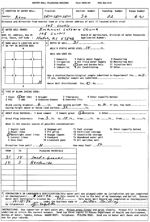
Specific Water Well Detail |
|
|
| Location Info | |||
| Owner: Emanuel Lutheran Church | Status: Plugged | ||
| Location: T22S, R6W, Sec. 36, SE SE SE | County: Reno | ||
| Directions: 105 Curtis, Hutchinson | |||
| Latitude: 38.0874486 | Longitude: -97.9228383 | Datum NAD 27 | |
| Latitude: 38.0874596 | Longitude: -97.923168 | Datum NAD 83 | |
| Longitude and latitude calculated by Survey from township-range-section-quarter calls. Only good to within the quarter call accuracy. | |||
| View well on interactive map | |||
| General Info | ||
| Well Depth: 31 ft. | Elevation: ft. | |
| Static Water Level: 14 ft. | Est. Yield: gpm. | |
| Comp. Date: 20-Aug-1996 | Well Use: Domestic, Lawn and Garden | |
| DWR Applic. #: | Other ID: | |
| Driller Info | ||
| Driller: Miller Drilling | License #: 447 | |
| Scanned Form | View scan |
| Casing Info | ||
|
Casing Type: RMP(SR)
Diam: 6 in. Casing height above land surface: in | ||
| Grout Info | ||
| Grout used: Bentonite | From: 3 to 14 ft
From: 0 to 0 ft From: 0 to 0 ft | |
| Source of Possible Contamination | ||
| Source: Watertight sewer lines | ||
| Direction from well: N | Distance: 50 ft | |