|
|
|
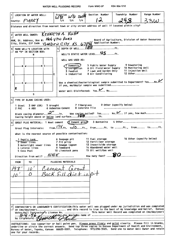
Specific Water Well Detail |
|
|
| Location Info | |||
| Owner: Kuhn, Kenneth A. | Status: Plugged | ||
| Location: T24S, R33W, Sec. 12, W2 W2 SW | County: Finney | ||
| Directions: | |||
| Latitude: 37.9785997 | Longitude: -100.9001621 | Datum NAD 27 | |
| Latitude: 37.978623 | Longitude: -100.9006028 | Datum NAD 83 | |
| Longitude and latitude calculated by Survey from township-range-section-quarter calls. Only good to within the quarter call accuracy. | |||
| View well on interactive map | |||
| General Info | ||
| Well Depth: 188 ft. | Elevation: ft. | |
| Static Water Level: 45 ft. | Est. Yield: gpm. | |
| Comp. Date: 09-Nov-1996 | Well Use: Domestic | |
| DWR Applic. #: | Other ID: | |
| Driller Info | ||
| Driller: Kenneth A. Kuhn | License #: | |
| Scanned Form | View scan |
| Casing Info | ||
|
Casing Type: OTHER
Diam: 2 in. Casing height above land surface: in | ||
| Grout Info | ||
| Grout used: Cement grout | From: 198 to 10 ft
From: 0 to 0 ft From: 0 to 0 ft | |
| Source of Possible Contamination | ||
| Source: Septic Tank | ||
| Direction from well: NE | Distance: 80 ft | |