|
|
|
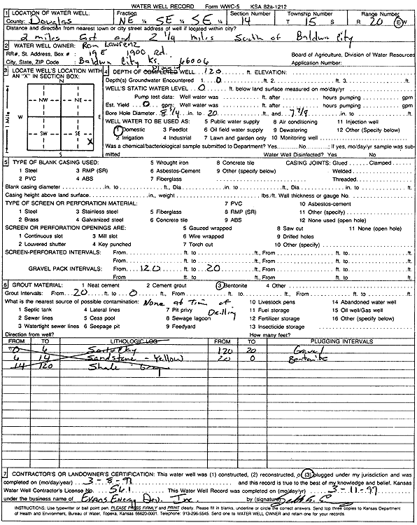
Specific Water Well Detail |
|
|
| Location Info | |||
| Owner: Lawrenz, Ron | Status: Plugged | ||
| Location: T15S, R20E, Sec. 14, NE SE SE | County: Douglas | ||
| Directions: from Baldwin City: 2 mi E, 2.25 mi S | |||
| Latitude: 38.741231 | Longitude: -95.1498394 | Datum NAD 27 | |
| Latitude: 38.7412391 | Longitude: -95.1500877 | Datum NAD 83 | |
| Longitude and latitude calculated by Survey from township-range-section-quarter calls. Only good to within the quarter call accuracy. | |||
| View well on interactive map | |||
| General Info | ||
| Well Depth: 120 ft. | Elevation: ft. | |
| Static Water Level: ft. | Est. Yield: gpm. | |
| Comp. Date: 08-Mar-1997 | Well Use: Domestic | |
| DWR Applic. #: | Other ID: | |
| Driller Info | ||
| Driller: Evans Energy Development, Inc. | License #: 561 | |
| Scanned Form | View scan |
| Casing Info | ||
|
Casing Type: Steel
Diam: 5 in. Casing height above land surface: in | ||
| Grout Info | ||
| Grout used: Bentonite | From: 20 to 0 ft
From: 0 to 0 ft From: 0 to 0 ft | |
| Source of Possible Contamination | ||
| Source: | ||
| Direction from well: | Distance: 0 ft | |