|
|
|
Specific Water Well Detail |
|
|
| Location Info | |||
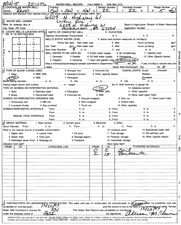
| Owner: Lackey, Inc. | Status: Plugged | ||
| Location: T22S, R5W, Sec. 22, SW SW NW | County: Reno | ||
| Directions: 6209 N Hwy 61 | |||
| Latitude: 38.1238184 | Longitude: -97.8654676 | Datum NAD 27 | |
| Latitude: 38.123829 | Longitude: -97.8657956 | Datum NAD 83 | |
| Longitude and latitude calculated by Survey from township-range-section-quarter calls. Only good to within the quarter call accuracy. | |||
| View well on interactive map | |||
| General Info | ||
| Well Depth: 15 ft. | Elevation: ft. | |
| Static Water Level: ft. | Est. Yield: gpm. | |
| Comp. Date: 22-Dec-1997 | Well Use: Monitoring well/observation/piezometer | |
| DWR Applic. #: | Other ID: | |
| Driller Info | ||
| Driller: Geotechnical Services, Inc. | License #: 531 | |
| Scanned Form | View scan |
| Casing Info | ||
|
Casing Type: PVC
Diam: 0 in. Casing height above land surface: in | ||
| Grout Info | ||
| Grout used: | From: 999 to 999 ft
From: 0 to 0 ft From: 0 to 0 ft | |
| Source of Possible Contamination | ||
| Source: | ||
| Direction from well: | Distance: 0 ft | |