|
|
|
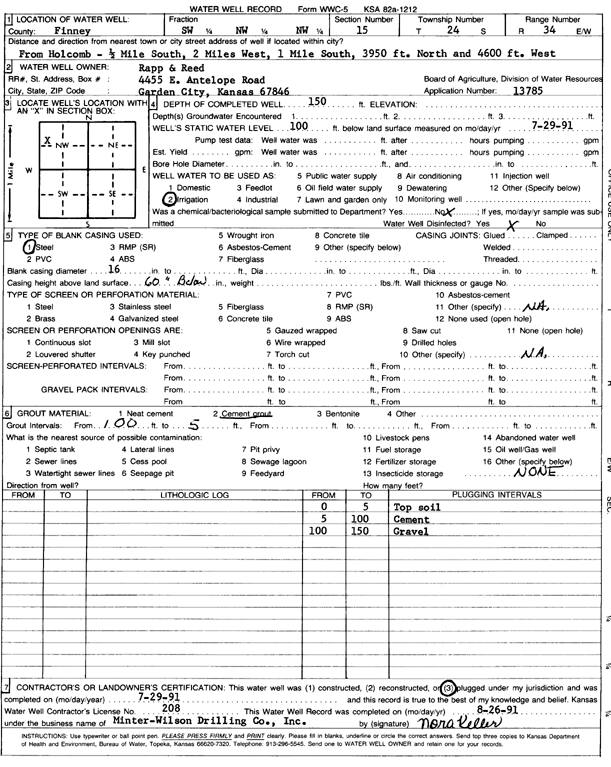
Specific Water Well Detail |
|
|
| Location Info | |||
| Owner: Rapp and Reed | Status: Plugged | ||
| Location: T24S, R34W, Sec. 15, SW NW NW | County: Finney | ||
| Directions: from Holcomb: 0.5 mi S, 2 mi W, 1 mi S, 3950 feet N, and 4600 feet W | |||
| Latitude: 37.9716591 | Longitude: -101.0465905 | Datum NAD 27 | |
| Latitude: 37.9716827 | Longitude: -101.0470357 | Datum NAD 83 | |
| Longitude and latitude calculated by Survey from township-range-section-quarter calls. Only good to within the quarter call accuracy. | |||
| View well on interactive map | |||
| General Info | ||
| Well Depth: 150 ft. | Elevation: ft. | |
| Static Water Level: 100 ft. | Est. Yield: gpm. | |
| Comp. Date: 29-Jul-1991 | Well Use: Irrigation | |
| DWR Applic. #: 13785 | Other ID: | |
| Links | |
| View info from Wizard Water Level Data base... | |
| View info from WIMAS Water Right Data base... | |
| Driller Info | ||
| Driller: Minter-Wilson Drlg. Co., Inc. | License #: 208 | |
| Scanned Form | View scan |
| Casing Info | ||
|
Casing Type: Steel
Diam: 16 in. Casing height above land surface: in | ||
| Grout Info | ||
| Grout used: Cement grout | From: 5 to 100 ft
From: 0 to 0 ft From: 0 to 0 ft | |
| Source of Possible Contamination | ||
| Source: OTHER | ||
| Direction from well: | Distance: 0 ft | |