|
|
|
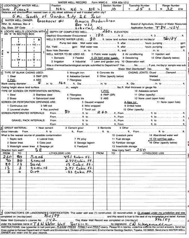
Specific Water Well Detail |
|
|
| Location Info | |||
| Owner: Amoco Production | Status: Plugged | ||
| Location: T25S, R32W, Sec. 10, NE NE NE | County: Finney | ||
| Directions: from Garden City, 5 mi S, 3 mi E, and 0.5 W | |||
| Latitude: 37.9012899 | Longitude: -100.8114961 | Datum NAD 27 | |
| Latitude: 37.9013129 | Longitude: -100.8119341 | Datum NAD 83 | |
| Longitude and latitude calculated by Survey from township-range-section-quarter calls. Only good to within the quarter call accuracy. | |||
| View well on interactive map | |||
| General Info | ||
| Well Depth: 260 ft. | Elevation: ft. | |
| Static Water Level: 80 ft. | Est. Yield: gpm. | |
| Comp. Date: 15-Aug-1984 | Well Use: Oil Field Water Supply | |
| DWR Applic. #: T84-454 | Other ID: Brookover 1 | |
| Driller Info | ||
| Driller: T & W Water Well Serv., Inc. | License #: 142 | |
| Scanned Form | View scan |
| Casing Info | ||
|
Casing Type: PVC
Diam: 5 in. Casing height above land surface: in | ||
| Grout Info | ||
| Grout used: | From: 0 to 0 ft
From: 0 to 0 ft From: 0 to 0 ft | |
| Source of Possible Contamination | ||
| Source: Oil well/gas well | ||
| Direction from well: | Distance: 0 ft | |