|
|
|
Specific Water Well Detail |
|
|
| Location Info | |||
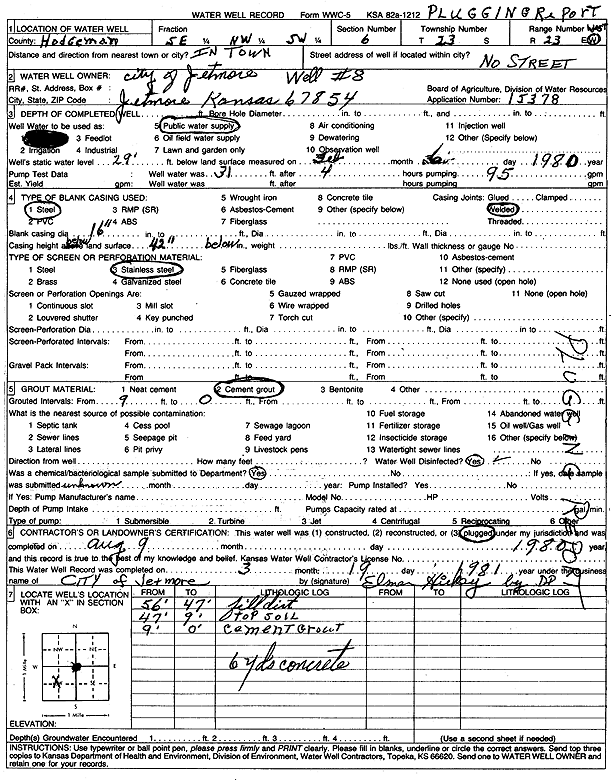
| Owner: City of Jetmore | Status: Plugged | ||
| Location: T23S, R23W, Sec. 6, SE NW SW | County: Hodgeman | ||
| Directions: in town | |||
| Latitude: 38.078266 | Longitude: -99.894724 | Datum NAD 27 | |
| Latitude: 38.0782843 | Longitude: -99.8951305 | Datum NAD 83 | |
| Longitude and latitude calculated by Survey from township-range-section-quarter calls. Only good to within the quarter call accuracy. | |||
| View well on interactive map | |||
| General Info | ||
| Well Depth: 56 ft. | Elevation: ft. | |
| Static Water Level: 29 ft. | Est. Yield: gpm. | |
| Comp. Date: 09-Aug-1980 | Well Use: Public Water Supply | |
| DWR Applic. #: 15378 | Other ID: | |
| Driller Info | ||
| Driller: Minter-Wilson Drlg. Co., Inc. | License #: 208 | |
| Scanned Form | View scan |
| Casing Info | ||
|
Casing Type:
Diam: 0 in. Casing height above land surface: in | ||
| Grout Info | ||
| Grout used: | From: 0 to 0 ft
From: 0 to 0 ft From: 0 to 0 ft | |
| Source of Possible Contamination | ||
| Source: | ||
| Direction from well: | Distance: 0 ft | |