|
|
|
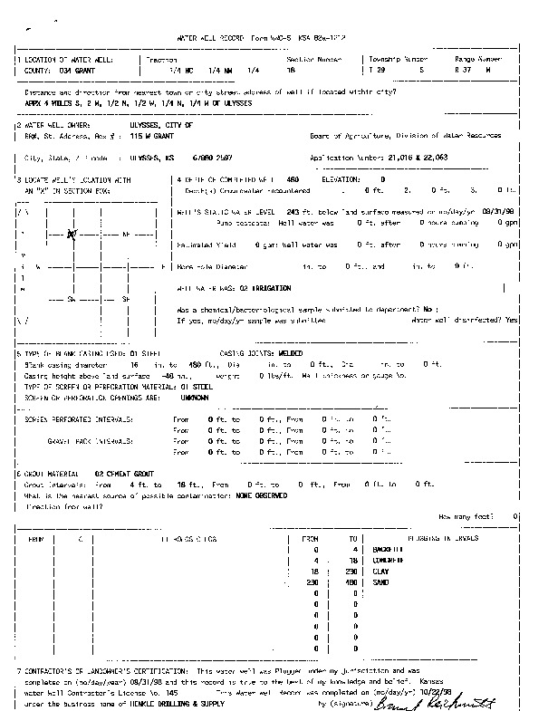
Specific Water Well Detail |
|
|
| Location Info | |||
| Owner: City of Ulysses | Status: Plugged | ||
| Location: T29S, R37W, Sec. 18, NW | County: Grant | ||
| Directions: from Ulysses: 4 mi S, 2 mi W, .5 mi N, .5 mi W, .25 mi N, .25 mi W | |||
| Latitude: 37.5293588 | Longitude: -101.4120948 | Datum NAD 27 | |
| Latitude: 37.52938 | Longitude: -101.4125412 | Datum NAD 83 | |
| Longitude and latitude calculated by Survey from township-range-section-quarter calls. Only good to within the quarter call accuracy. | |||
| View well on interactive map | |||
| General Info | ||
| Well Depth: 480 ft. | Elevation: ft. | |
| Static Water Level: 243 ft. | Est. Yield: gpm. | |
| Comp. Date: 31-Aug-1998 | Well Use: Irrigation | |
| DWR Applic. #: 21016 and 22063 | Other ID: | |
| Links | |
| No Wizard information available. | |
| View info from WIMAS Water Right Data base... | |
| Driller Info | ||
| Driller: Henkle Drilling & Supply Co. Inc. | License #: 145 | |
| Scanned Form | View scan |
| Casing Info | ||
|
Casing Type:
Diam: in. Casing height above land surface: in | ||
| Grout Info | ||
| Grout used: | From: to ft | |
| Source of Possible Contamination | ||
| Source: | ||
| Direction from well: | Distance: ft | |