|
|
|
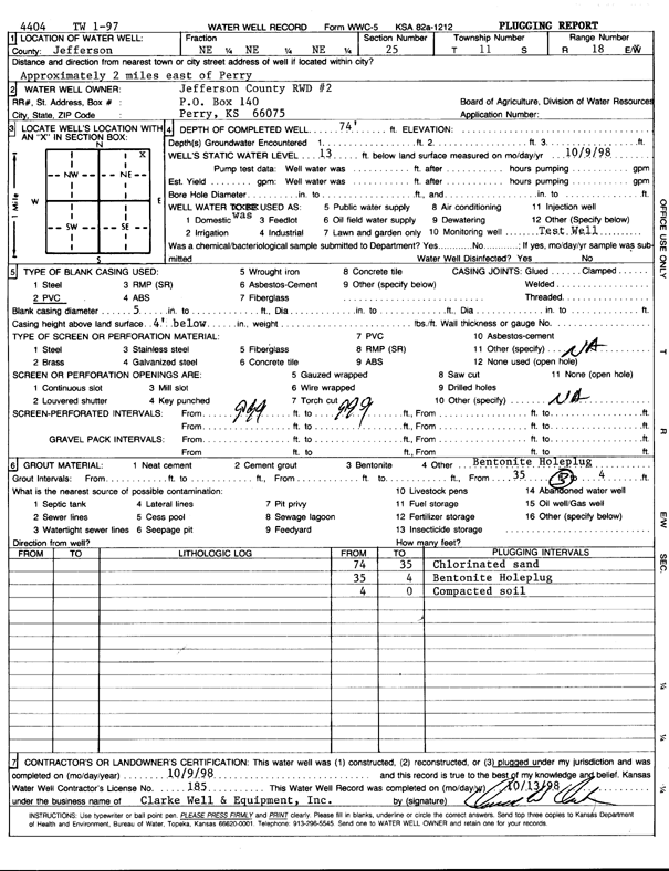
Specific Water Well Detail |
|
|
| Location Info | |||
| Owner: Jefferson Co. RWD 2 | Status: Plugged | ||
| Location: T11S, R18E, Sec. 25, NE NE NE | County: Jefferson | ||
| Directions: from Perry: 2 mi E | |||
| Latitude: 39.0719439 | Longitude: -95.3550571 | Datum NAD 27 | |
| Latitude: 39.0719442 | Longitude: -95.3553086 | Datum NAD 83 | |
| Longitude and latitude calculated by Survey from township-range-section-quarter calls. Only good to within the quarter call accuracy. | |||
| View well on interactive map | |||
| General Info | ||
| Well Depth: 74 ft. | Elevation: ft. | |
| Static Water Level: 13 ft. | Est. Yield: gpm. | |
| Comp. Date: 09-Oct-1998 | Well Use: Test hole/well | |
| DWR Applic. #: 4404 | Other ID: TW 1-97 | |
| Driller Info | ||
| Driller: Clarke Well and Equipment, Inc. | License #: 185 | |
| Scanned Form | View scan |
| Casing Info | ||
|
Casing Type:
Diam: in. Casing height above land surface: in | ||
| Grout Info | ||
| Grout used: | From: to ft | |
| Source of Possible Contamination | ||
| Source: | ||
| Direction from well: | Distance: ft | |