|
|
|
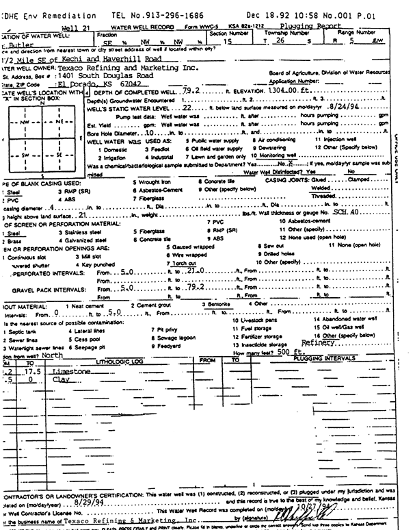
Specific Water Well Detail |
|
|
| Location Info | |||
| Owner: Texaco Refining and Marketing, Inc. | Status: Plugged | ||
| Location: T26S, R5E, Sec. 15, SE NW NW | County: Butler | ||
| Directions: from Kechi and Haverhill Rd: .5 mi SE | |||
| Latitude: 37.7927809 | Longitude: -96.8766355 | Datum NAD 27 | |
| Latitude: 37.7927986 | Longitude: -96.8769445 | Datum NAD 83 | |
| Longitude and latitude calculated by Survey from township-range-section-quarter calls. Only good to within the quarter call accuracy. | |||
| View well on interactive map | |||
| General Info | ||
| Well Depth: 79.2 ft. | Elevation: 1304 ft. | |
| Static Water Level: 22 ft. | Est. Yield: gpm. | |
| Comp. Date: 29-Aug-1994 | Well Use: Monitoring well/observation/piezometer | |
| DWR Applic. #: | Other ID: Well 21 | |
| Driller Info | ||
| Driller: Texaco Refining & Marketing, Inc. | License #: | |
| Scanned Form | View scan |
| Casing Info | ||
|
Casing Type:
Diam: in. Casing height above land surface: in | ||
| Grout Info | ||
| Grout used: | From: to ft | |
| Source of Possible Contamination | ||
| Source: | ||
| Direction from well: | Distance: ft | |