|
|
|
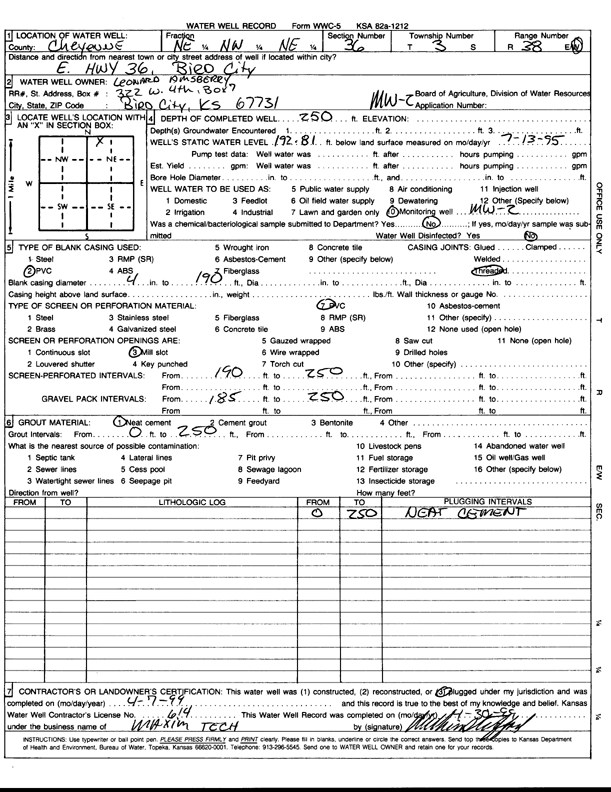
Specific Water Well Detail |
|
|
| Location Info | |||
| Owner: Amsberry, Leonard | Status: Plugged | ||
| Location: T3S, R38W, Sec. 36, NE NW NE | County: Cheyenne | ||
| Directions: In Bird City, East Hwy 36 | |||
| Latitude: 39.7558536 | Longitude: -101.5287628 | Datum NAD 27 | |
| Latitude: 39.7558491 | Longitude: -101.5292065 | Datum NAD 83 | |
| Longitude and latitude calculated by Survey from township-range-section-quarter calls. Only good to within the quarter call accuracy. | |||
| View well on interactive map | |||
| General Info | ||
| Well Depth: 250 ft. | Elevation: ft. | |
| Static Water Level: 192.8 ft. | Est. Yield: gpm. | |
| Comp. Date: 07-Apr-1999 | Well Use: Monitoring well/observation/piezometer | |
| DWR Applic. #: | Other ID: MW 2 | |
| Driller Info | ||
| Driller: Maxim Technologies, Inc. | License #: 614 | |
| Scanned Form | View scan |
| Casing Info | ||
|
Casing Type:
Diam: in. Casing height above land surface: in | ||
| Grout Info | ||
| Grout used: | From: to ft | |
| Source of Possible Contamination | ||
| Source: | ||
| Direction from well: | Distance: ft | |