|
|
|
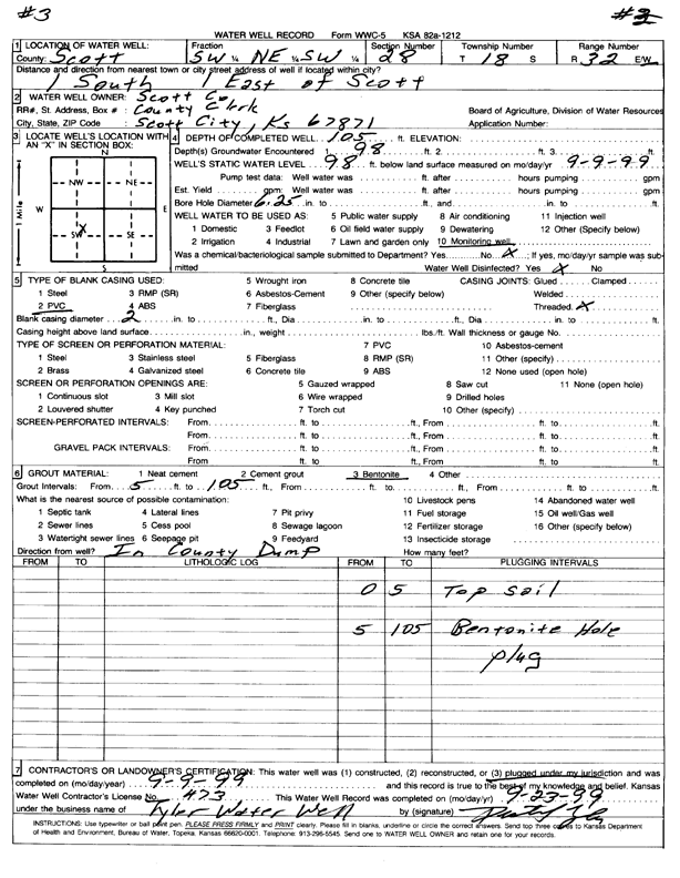
Specific Water Well Detail |
|
|
| Location Info | |||
| Owner: Scott County | Status: Plugged | ||
| Location: T18S, R32W, Sec. 28, SW NE SW | County: Scott | ||
| Directions: from Scott: 1 mi S, 1 mi E | |||
| Latitude: 38.4581245 | Longitude: -100.8637205 | Datum NAD 27 | |
| Latitude: 38.4581437 | Longitude: -100.8641488 | Datum NAD 83 | |
| Longitude and latitude calculated by Survey from township-range-section-quarter calls. Only good to within the quarter call accuracy. | |||
| View well on interactive map | |||
| General Info | ||
| Well Depth: 105 ft. | Elevation: ft. | |
| Static Water Level: 98 ft. | Est. Yield: gpm. | |
| Comp. Date: 09-Sep-1999 | Well Use: Monitoring well/observation/piezometer | |
| DWR Applic. #: | Other ID: 3 | |
| Driller Info | ||
| Driller: Tyler Water Well, Inc. | License #: 473 | |
| Scanned Form | View scan |
| Casing Info | ||
|
Casing Type:
Diam: in. Casing height above land surface: in | ||
| Grout Info | ||
| Grout used: | From: to ft | |
| Source of Possible Contamination | ||
| Source: | ||
| Direction from well: | Distance: ft | |