| Location Info |
| |
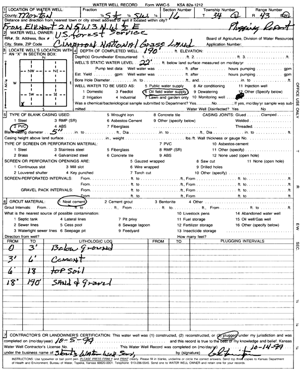
Owner: Cimarron National Grassland |
Status: Plugged |
| |
Location: T34S, R43W, Sec. 16, S2 SW |
County: Morton |
| |
Directions: From Elkhart, 2 miles North, 5 miles West, 3 miles Northwest, and 0.5 mile East N, 5 mi W, 3 mi NW, .5 mi E from Elkhart |
| |
Latitude: 37.0847574 |
Longitude: -102.0030118 |
Datum NAD 27 |
| |
Latitude: 37.0847795 |
Longitude: -102.0034606 |
Datum NAD 83 |
| |
Longitude and latitude calculated by Survey from township-range-section-quarter calls. Only good to within the quarter call accuracy. |
| |
View well on interactive map
|