|
|
|
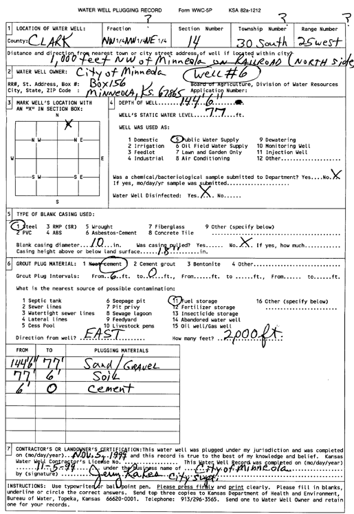
Specific Water Well Detail |
|
|
| Location Info | |||
| Owner: City of Minneola | Status: Plugged | ||
| Location: T30S, R25W, Sec. 14, NW NW NE | County: Clark | ||
| Directions: from Minneola: 1000' NW on RR, N side | |||
| Latitude: 37.4427962 | Longitude: -100.0234429 | Datum NAD 27 | |
| Latitude: 37.4428188 | Longitude: -100.0238566 | Datum NAD 83 | |
| Longitude and latitude calculated by Survey from township-range-section-quarter calls. Only good to within the quarter call accuracy. | |||
| View well on interactive map | |||
| General Info | ||
| Well Depth: 144.5 ft. | Elevation: ft. | |
| Static Water Level: 77 ft. | Est. Yield: gpm. | |
| Comp. Date: 05-Nov-1999 | Well Use: Public Water Supply | |
| DWR Applic. #: | Other ID: Well 6 | |
| Driller Info | ||
| Driller: City of Minneola | License #: | |
| Scanned Form | View scan |
| Casing Info | ||
|
Casing Type:
Diam: in. Casing height above land surface: in | ||
| Grout Info | ||
| Grout used: | From: to ft | |
| Source of Possible Contamination | ||
| Source: | ||
| Direction from well: | Distance: ft | |