|
|
|
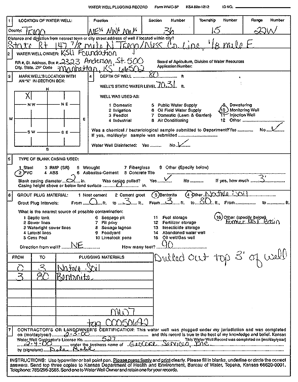
Specific Water Well Detail |
|
|
| Location Info | |||
| Owner: KSU Foundation | Status: Plugged | ||
| Location: T15S, R22W, Sec. 36, NE NW NW | County: Trego | ||
| Directions: from Trego/Ness Co. Line, 0.8 mi N on Hwy 147, 0.13 mi E (tag 0050692) | |||
| Latitude: 38.7102377 | Longitude: -99.7239974 | Datum NAD 27 | |
| Latitude: 38.7102512 | Longitude: -99.724392 | Datum NAD 83 | |
| Longitude and latitude calculated by Survey from township-range-section-quarter calls. Only good to within the quarter call accuracy. | |||
| View well on interactive map | |||
| General Info | ||
| Well Depth: 80 ft. | Elevation: ft. | |
| Static Water Level: 70.31 ft. | Est. Yield: gpm. | |
| Comp. Date: 03-Feb-2000 | Well Use: Monitoring well/observation/piezometer | |
| DWR Applic. #: | Other ID: MW 7 | |
| Driller Info | ||
| Driller: GeoCore Services Inc. | License #: 527 | |
| Scanned Form | View scan |
| Casing Info | ||
|
Casing Type:
Diam: in. Casing height above land surface: in | ||
| Grout Info | ||
| Grout used: | From: to ft | |
| Source of Possible Contamination | ||
| Source: | ||
| Direction from well: | Distance: ft | |