|
|
|
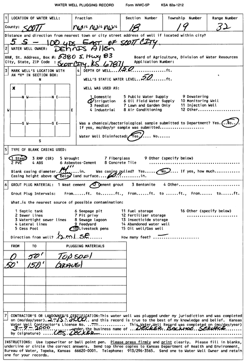
Specific Water Well Detail |
|
|
| Location Info | |||
| Owner: Allen, Dennis | Status: Plugged | ||
| Location: T19S, R32W, Sec. 18, NW NW NW | County: Scott | ||
| Directions: from Scott City: 5 mi S, 100 yds E | |||
| Latitude: 38.4091137 | Longitude: -100.9046923 | Datum NAD 27 | |
| Latitude: 38.4091338 | Longitude: -100.9051226 | Datum NAD 83 | |
| Longitude and latitude calculated by Survey from township-range-section-quarter calls. Only good to within the quarter call accuracy. | |||
| View well on interactive map | |||
| General Info | ||
| Well Depth: 150 ft. | Elevation: ft. | |
| Static Water Level: 50 ft. | Est. Yield: gpm. | |
| Comp. Date: 15-Feb-2000 | Well Use: Irrigation | |
| DWR Applic. #: | Other ID: | |
| Links | |
| View info from Wizard Water Level Data base... | |
| View info from WIMAS Water Right Data base... | |
| Driller Info | ||
| Driller: Decker Backhoe Service | License #: | |
| Scanned Form | View scan |
| Casing Info | ||
|
Casing Type:
Diam: in. Casing height above land surface: in | ||
| Grout Info | ||
| Grout used: | From: to ft | |
| Source of Possible Contamination | ||
| Source: | ||
| Direction from well: | Distance: ft | |