|
|
|
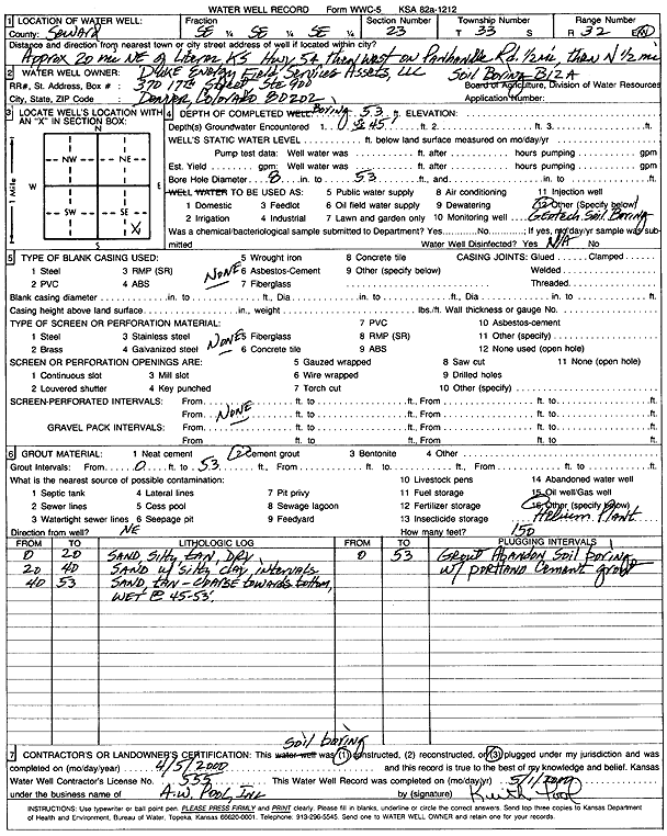
Specific Water Well Detail |
|
|
| Location Info | |||
| Owner: Duke Energy Field Services Assets, LLC | Status: Plugged | ||
| Location: T33S, R32W, Sec. 23, SE SE SE | County: Seward | ||
| Directions: from Liberal: 20 mi NE on Hwy 54, .5 mi W on Panhandle Rd, .5 mi N | |||
| Latitude: 37.1561575 | Longitude: -100.760947 | Datum NAD 27 | |
| Latitude: 37.1561794 | Longitude: -100.761383 | Datum NAD 83 | |
| Longitude and latitude calculated by Survey from township-range-section-quarter calls. Only good to within the quarter call accuracy. | |||
| View well on interactive map | |||
| General Info | ||
| Well Depth: 53 ft. | Elevation: ft. | |
| Static Water Level: ft. | Est. Yield: gpm. | |
| Comp. Date: 05-Apr-2000 | Well Use: Test hole/well | |
| DWR Applic. #: | Other ID: Soil Boring B12A | |
| Driller Info | ||
| Driller: Keith Pool, A. W. Pool, Inc. | License #: 555 | |
| Scanned Form | View scan |
| Casing Info | ||
|
Casing Type:
Diam: in. Casing height above land surface: in | ||
| Grout Info | ||
| Grout used: | From: to ft | |
| Source of Possible Contamination | ||
| Source: | ||
| Direction from well: | Distance: ft | |