|
|
|
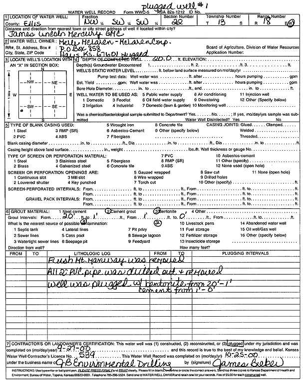
Specific Water Well Detail |
|
|
| Location Info | |||
| Owner: McLaren, Merle | Status: Plugged | ||
| Location: T13S, R18W, Sec. 22, NW SW SW | County: Ellis | ||
| Directions: James Linclon Mercury GMC | |||
| Latitude: 38.9027448 | Longitude: -99.3160321 | Datum NAD 27 | |
| Latitude: 38.9027563 | Longitude: -99.3164131 | Datum NAD 83 | |
| Longitude and latitude calculated by Survey from township-range-section-quarter calls. Only good to within the quarter call accuracy. | |||
| View well on interactive map | |||
| General Info | ||
| Well Depth: 20 ft. | Elevation: ft. | |
| Static Water Level: ft. | Est. Yield: gpm. | |
| Comp. Date: 27-Sep-2000 | Well Use: (unstated)/abandoned | |
| DWR Applic. #: | Other ID: Well 1 | |
| Driller Info | ||
| Driller: JB Environmental Drilling | License #: 539 | |
| Scanned Form | View scan |
| Casing Info | ||
|
Casing Type:
Diam: in. Casing height above land surface: in | ||
| Grout Info | ||
| Grout used: | From: to ft | |
| Source of Possible Contamination | ||
| Source: | ||
| Direction from well: | Distance: ft | |