|
|
|
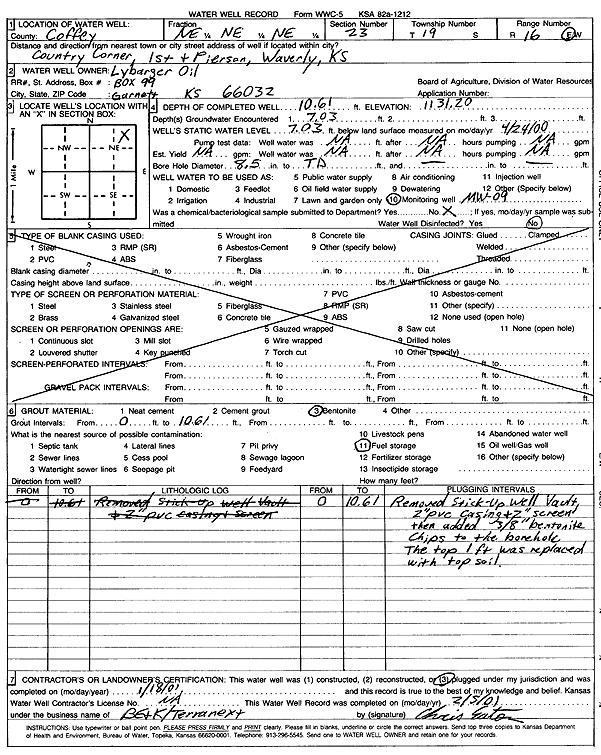
Specific Water Well Detail |
|
|
| Location Info | |||
| Owner: Lybarger Oil | Status: Plugged | ||
| Location: T19S, R16E, Sec. 23, NE NE NE | County: Coffey | ||
| Directions: Country Corner, 1st St and Pearson Ave, Waverly | |||
| Latitude: 38.3894711 | Longitude: -95.601036 | Datum NAD 27 | |
| Latitude: 38.3894876 | Longitude: -95.6012977 | Datum NAD 83 | |
| Longitude and latitude calculated by Survey from township-range-section-quarter calls. Only good to within the quarter call accuracy. | |||
| View well on interactive map | |||
| General Info | ||
| Well Depth: 10.61 ft. | Elevation: 1131.2 ft. | |
| Static Water Level: 7.03 ft. | Est. Yield: gpm. | |
| Comp. Date: 18-Jan-2001 | Well Use: Monitoring well/observation/piezometer | |
| DWR Applic. #: | Other ID: MW 9 | |
| Driller Info | ||
| Driller: B E and K Terranext | License #: | |
| Scanned Form | View scan |
| Casing Info | ||
|
Casing Type:
Diam: in. Casing height above land surface: in | ||
| Grout Info | ||
| Grout used: | From: to ft | |
| Source of Possible Contamination | ||
| Source: | ||
| Direction from well: | Distance: ft | |