|
|
|
Specific Water Well Detail |
|
|
| Location Info | |||
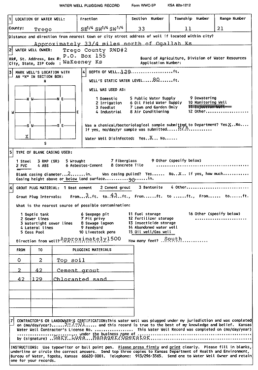
| Owner: Trego County RWD 2 | Status: Plugged | ||
| Location: T11S, R21W, Sec. 33, SE SW SW | County: Trego | ||
| Directions: from Ogallah: 3.75 mi N | |||
| Latitude: 39.045772 | Longitude: -99.6639092 | Datum NAD 27 | |
| Latitude: 39.045781 | Longitude: -99.6643015 | Datum NAD 83 | |
| Longitude and latitude calculated by Survey from township-range-section-quarter calls. Only good to within the quarter call accuracy. | |||
| View well on interactive map | |||
| General Info | ||
| Well Depth: 129 ft. | Elevation: ft. | |
| Static Water Level: 80 ft. | Est. Yield: gpm. | |
| Comp. Date: 07-May-2001 | Well Use: Monitoring well/observation/piezometer | |
| DWR Applic. #: | Other ID: | |
| Driller Info | ||
| Driller: Trego County RWD 2 | License #: | |
| Scanned Form | View scan |
| Casing Info | ||
|
Casing Type:
Diam: in. Casing height above land surface: in | ||
| Grout Info | ||
| Grout used: | From: to ft | |
| Source of Possible Contamination | ||
| Source: | ||
| Direction from well: | Distance: ft | |