|
|
|
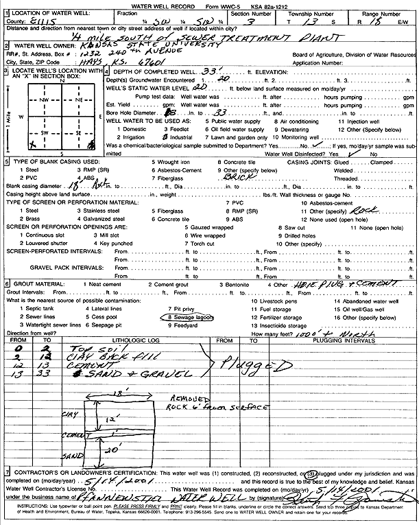
Specific Water Well Detail |
|
|
| Location Info | |||
| Owner: Kansas State University | Status: Plugged | ||
| Location: T13S, R18W, Sec. 3, SW SW | County: Ellis | ||
| Directions: .25 mi S of sewer treatment plant | |||
| Latitude: 38.945328 | Longitude: -99.3142042 | Datum NAD 27 | |
| Latitude: 38.9453392 | Longitude: -99.3145849 | Datum NAD 83 | |
| Longitude and latitude calculated by Survey from township-range-section-quarter calls. Only good to within the quarter call accuracy. | |||
| View well on interactive map | |||
| General Info | ||
| Well Depth: 33 ft. | Elevation: ft. | |
| Static Water Level: 20 ft. | Est. Yield: gpm. | |
| Comp. Date: 14-May-2001 | Well Use: Industrial | |
| DWR Applic. #: | Other ID: | |
| Driller Info | ||
| Driller: Pfannenstiel Water Well Service | License #: 478 | |
| Scanned Form | View scan |
| Casing Info | ||
|
Casing Type:
Diam: in. Casing height above land surface: in | ||
| Grout Info | ||
| Grout used: | From: to ft | |
| Source of Possible Contamination | ||
| Source: | ||
| Direction from well: | Distance: ft | |