|
|
|
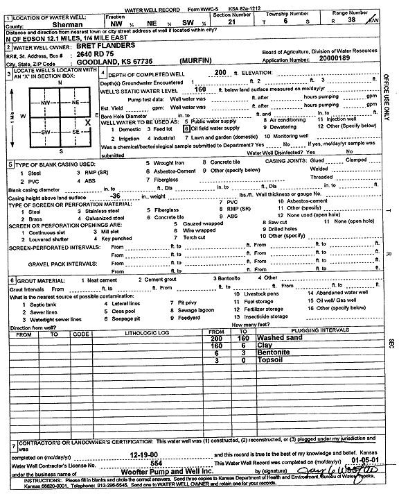
Specific Water Well Detail |
|
|
| Location Info | |||
| Owner: Flanders, Bret | Status: Plugged | ||
| Location: T6S, R38W, Sec. 21, NW NE SW | County: Sherman | ||
| Directions: from Edson, 12.1 mi N and 0.25 mi E | |||
| Latitude: 39.5173725 | Longitude: -101.5705522 | Datum NAD 27 | |
| Latitude: 39.5173704 | Longitude: -101.5709982 | Datum NAD 83 | |
| Longitude and latitude calculated by Survey from township-range-section-quarter calls. Only good to within the quarter call accuracy. | |||
| View well on interactive map | |||
| General Info | ||
| Well Depth: 200 ft. | Elevation: ft. | |
| Static Water Level: 160 ft. | Est. Yield: gpm. | |
| Comp. Date: 19-Dec-2000 | Well Use: Oil Field Water Supply | |
| DWR Applic. #: 20000189 | Other ID: | |
| Links | |
| No Wizard information available. | |
| View info from WIMAS Water Right Data base... | |
| Driller Info | ||
| Driller: Jay C. Woofter Pump & Well, Inc. | License #: 554 | |
| Scanned Form | View scan |
| Casing Info | ||
|
Casing Type:
Diam: in. Casing height above land surface: in | ||
| Grout Info | ||
| Grout used: | From: to ft | |
| Source of Possible Contamination | ||
| Source: | ||
| Direction from well: | Distance: ft | |