|
|
|
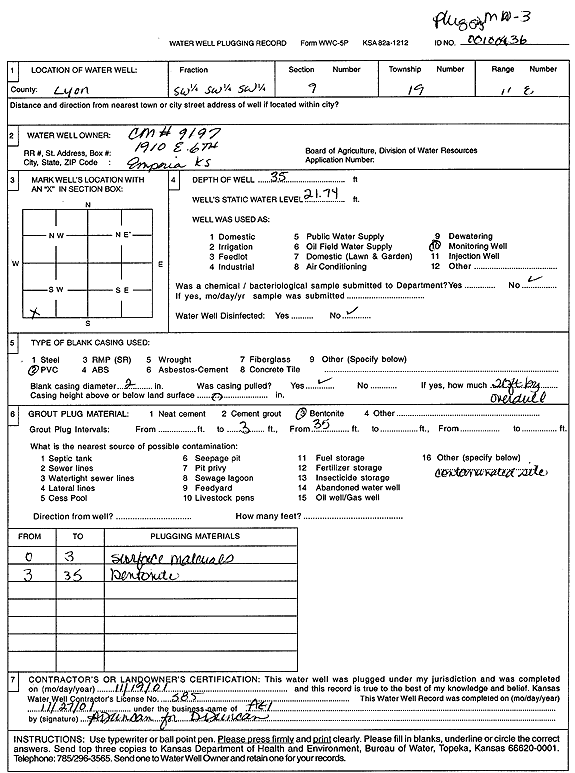
Specific Water Well Detail |
|
|
| Location Info | |||
| Owner: Coastal Mart 9197 | Status: Plugged | ||
| Location: T19S, R11E, Sec. 9, SW SW SW | County: Lyon | ||
| Directions: 1910 W 6th Ave, Emporia (tag 00100436) | |||
| Latitude: 38.4059355 | Longitude: -96.2065595 | Datum NAD 27 | |
| Latitude: 38.4059495 | Longitude: -96.2068339 | Datum NAD 83 | |
| Longitude and latitude calculated by Survey from township-range-section-quarter calls. Only good to within the quarter call accuracy. | |||
| View well on interactive map | |||
| General Info | ||
| Well Depth: 35 ft. | Elevation: ft. | |
| Static Water Level: 21.74 ft. | Est. Yield: gpm. | |
| Comp. Date: 19-Nov-2001 | Well Use: Monitoring well/observation/piezometer | |
| DWR Applic. #: | Other ID: MW 3 | |
| Driller Info | ||
| Driller: Associated Environmental, Inc. | License #: 585 | |
| Scanned Form | View scan |
| Casing Info | ||
|
Casing Type:
Diam: in. Casing height above land surface: in | ||
| Grout Info | ||
| Grout used: | From: to ft | |
| Source of Possible Contamination | ||
| Source: | ||
| Direction from well: | Distance: ft | |