|
|
|
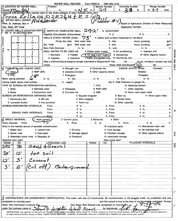
Specific Water Well Detail |
|
|
| Location Info | |||
| Owner: Anadarko Petroleum Corp. | Status: Plugged | ||
| Location: T33S, R39W, Sec. 29, NE | County: Morton | ||
| Directions: from Rolla: on 512 E, 2.75 mi N, .5 mi E, S into site | |||
| Latitude: 37.1523303 | Longitude: -101.5779694 | Datum NAD 27 | |
| Latitude: 37.1523554 | Longitude: -101.5784075 | Datum NAD 83 | |
| Longitude and latitude calculated by Survey from township-range-section-quarter calls. Only good to within the quarter call accuracy. | |||
| View well on interactive map | |||
| General Info | ||
| Well Depth: 292 ft. | Elevation: ft. | |
| Static Water Level: 78 ft. | Est. Yield: gpm. | |
| Comp. Date: 11-Sep-2001 | Well Use: Oil Field Water Supply | |
| DWR Applic. #: | Other ID: Fiddler A-1 | |
| Driller Info | ||
| Driller: Stout's Water Well Service, Inc. | License #: 641 | |
| Scanned Form | View scan |
| Casing Info | ||
|
Casing Type:
Diam: in. Casing height above land surface: in | ||
| Grout Info | ||
| Grout used: | From: to ft | |
| Source of Possible Contamination | ||
| Source: | ||
| Direction from well: | Distance: ft | |