|
|
|
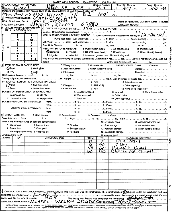
Specific Water Well Detail |
|
|
| Location Info | |||
| Owner: Long, Martin M. | Status: Plugged | ||
| Location: T27S, R36W, Sec. 23, NW SE SE | County: Grant | ||
| Directions: from Hwy 25 and 160 Ulysses: 7 mi N, 8 mi E, 100' N | |||
| Latitude: 37.6806935 | Longitude: -101.2200688 | Datum NAD 27 | |
| Latitude: 37.6807137 | Longitude: -101.2205177 | Datum NAD 83 | |
| Longitude and latitude calculated by Survey from township-range-section-quarter calls. Only good to within the quarter call accuracy. | |||
| View well on interactive map | |||
| General Info | ||
| Well Depth: 140 ft. | Elevation: ft. | |
| Static Water Level: ft. | Est. Yield: gpm. | |
| Comp. Date: 20-Dec-2001 | Well Use: Domestic | |
| DWR Applic. #: | Other ID: | |
| Driller Info | ||
| Driller: Minter-Wilson Drlg. Co., Inc. | License #: 208 | |
| Scanned Form | View scan |
| Casing Info | ||
|
Casing Type:
Diam: in. Casing height above land surface: in | ||
| Grout Info | ||
| Grout used: | From: to ft | |
| Source of Possible Contamination | ||
| Source: | ||
| Direction from well: | Distance: ft | |