| Location Info |
| |
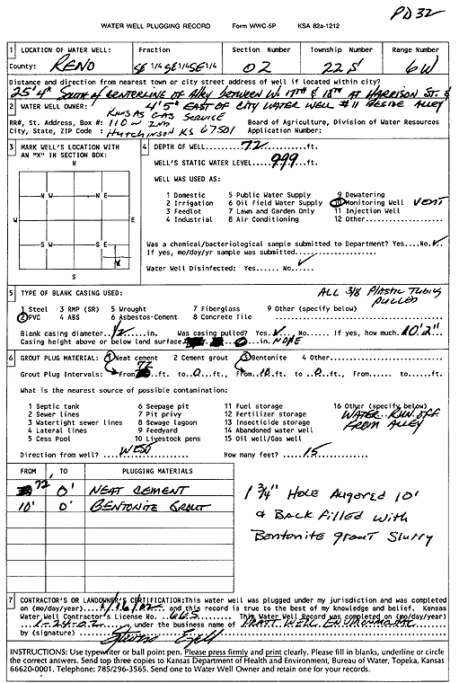
Owner: Kansas Gas Service |
Status: Plugged |
| |
Location: T22S, R6W, Sec. 2, SE SE SE |
County: Reno |
| |
Directions: from centerline of alley between 17th and 18th at Harrison St: 25.33' S, 4.42' E of city water well 11, beside alley |
| |
Latitude: 38.1601469 |
Longitude: -97.9413066 |
Datum NAD 27 |
| |
Latitude: 38.1601575 |
Longitude: -97.9416363 |
Datum NAD 83 |
| |
Longitude and latitude calculated by Survey from township-range-section-quarter calls. Only good to within the quarter call accuracy. |
| |
View well on interactive map
|