| Location Info |
| |
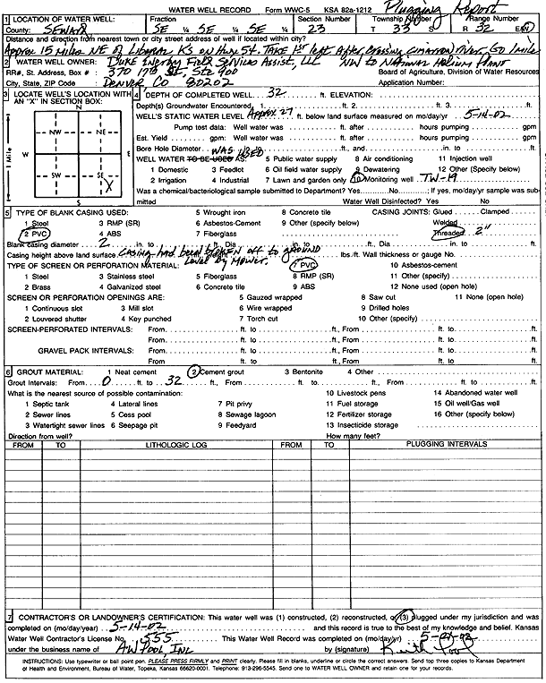
Owner: Duke Energy Field Services Assist., L.L.C. |
Status: Plugged |
| |
Location: T33S, R32W, Sec. 23, SE SE SE |
County: Seward |
| |
Directions: from Liberal: 15 mi NE on Hwy 54, first left after Cimarron River, 1 mi NW to National Helium Plant |
| |
Latitude: 37.1561575 |
Longitude: -100.760947 |
Datum NAD 27 |
| |
Latitude: 37.1561794 |
Longitude: -100.761383 |
Datum NAD 83 |
| |
Longitude and latitude calculated by Survey from township-range-section-quarter calls. Only good to within the quarter call accuracy. |
| |
View well on interactive map
|