|
|
|
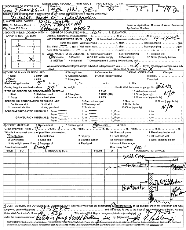
Specific Water Well Detail |
|
|
| Location Info | |||
| Owner: Smith, Bill | Status: Reconstructed | ||
| Location: T15S, R19E, Sec. 30, SE NW SE | County: Franklin | ||
| Directions: from Centropolis: .5 mi E | |||
| Latitude: 38.7141511 | Longitude: -95.3400793 | Datum NAD 27 | |
| Latitude: 38.7141589 | Longitude: -95.3403326 | Datum NAD 83 | |
| Longitude and latitude calculated by Survey from township-range-section-quarter calls. Only good to within the quarter call accuracy. | |||
| View well on interactive map | |||
| General Info | ||
| Well Depth: 150 ft. | Elevation: ft. | |
| Static Water Level: 30 ft. | Est. Yield: gpm. | |
| Comp. Date: 19-Sep-2002 | Well Use: Domestic | |
| DWR Applic. #: | Other ID: | |
| Driller Info | ||
| Driller: Tom Patchen Pump & Well Drlg. | License #: 536 | |
| Scanned Form | View scan |
|
Chemical Sample Submitted?:
Water Well disinfected?: | ||
| Casing Info | ||
| Casing Type:
Casing Joints: |
Diam: in. to ft | |
| Casing height above land surface: in
Casing Weight: lbs/ft Wall thickness or gauge no.: | ||
| Screen and Perforation Info | ||
| Screen Type: | Screen Openings: | |
| Screen-perforated intervals | From: ft to ft | |
| Gravel pack intervals | From: ft to ft | |
| Grout Info | ||
| Grout used: | From: to ft | |
| Source of Possible Contamination | ||
| Source: | ||
| Direction from well: | Distance: ft | |