|
|
|
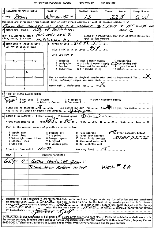
Specific Water Well Detail |
|
|
| Location Info | |||
| Owner: City of Hutchinson | Status: Plugged | ||
| Location: T22S, R6W, Sec. 13, NW NW SE | County: Reno | ||
| Directions: corner of Ave C and Walnut: 70' E & 15' S | |||
| Latitude: 38.1361005 | Longitude: -97.9299161 | Datum NAD 27 | |
| Latitude: 38.1361112 | Longitude: -97.9302456 | Datum NAD 83 | |
| Longitude and latitude calculated by Survey from township-range-section-quarter calls. Only good to within the quarter call accuracy. | |||
| View well on interactive map | |||
| General Info | ||
| Well Depth: 62.75 ft. | Elevation: ft. | |
| Static Water Level: ft. | Est. Yield: gpm. | |
| Comp. Date: 07-Feb-2003 | Well Use: Monitoring well/observation/piezometer | |
| DWR Applic. #: | Other ID: Well 8A | |
| Driller Info | ||
| Driller: Pratt Well Service, Inc. | License #: 665 | |
| Scanned Form | View scan |
| Casing Info | ||
|
Casing Type:
Diam: in. Casing height above land surface: in | ||
| Grout Info | ||
| Grout used: | From: to ft | |
| Source of Possible Contamination | ||
| Source: | ||
| Direction from well: | Distance: ft | |