|
|
|
Specific Water Well Detail |
|
|
| Location Info | |||
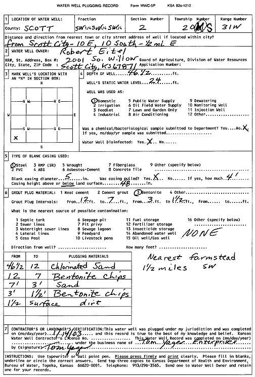
| Owner: Eitel, Robert | Status: Plugged | ||
| Location: T20S, R31W, Sec. 2, SW SW SW | County: Scott | ||
| Directions: from Scott City: 10 mi E, 10 mi S, .5 mi E | |||
| Latitude: 38.3383487 | Longitude: -100.7204175 | Datum NAD 27 | |
| Latitude: 38.3383682 | Longitude: -100.7208451 | Datum NAD 83 | |
| Longitude and latitude calculated by Survey from township-range-section-quarter calls. Only good to within the quarter call accuracy. | |||
| View well on interactive map | |||
| General Info | ||
| Well Depth: 46.5 ft. | Elevation: ft. | |
| Static Water Level: 24 ft. | Est. Yield: gpm. | |
| Comp. Date: 14-Jan-2003 | Well Use: Domestic | |
| DWR Applic. #: | Other ID: | |
| Driller Info | ||
| Driller: Tom Yager Enterprises | License #: | |
| Scanned Form | View scan |
| Casing Info | ||
|
Casing Type:
Diam: in. Casing height above land surface: in | ||
| Grout Info | ||
| Grout used: | From: to ft | |
| Source of Possible Contamination | ||
| Source: | ||
| Direction from well: | Distance: ft | |