|
|
|
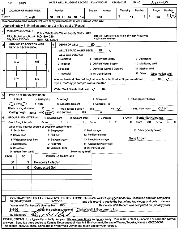
Specific Water Well Detail |
|
|
| Location Info | |||
| Owner: Public Wholesale Water Supply District 15 | Status: Plugged | ||
| Location: T14S, R13W, Sec. 31, NE SE NE | County: Russell | ||
| Directions: from Russell: 6.25 mi S, 3 mi E | |||
| Latitude: 38.7938076 | Longitude: -98.8002203 | Datum NAD 27 | |
| Latitude: 38.793819 | Longitude: -98.80058 | Datum NAD 83 | |
| Longitude and latitude calculated by Survey from township-range-section-quarter calls. Only good to within the quarter call accuracy. | |||
| View well on interactive map | |||
| General Info | ||
| Well Depth: 50 ft. | Elevation: ft. | |
| Static Water Level: 10 ft. | Est. Yield: gpm. | |
| Comp. Date: 27-Feb-2003 | Well Use: Monitoring well/observation/piezometer | |
| DWR Applic. #: 6483 | Other ID: Area 4 - LW | |
| Driller Info | ||
| Driller: Clarke Well and Equipment, Inc. | License #: 185 | |
| Scanned Form | View scan |
| Casing Info | ||
|
Casing Type:
Diam: in. Casing height above land surface: in | ||
| Grout Info | ||
| Grout used: | From: to ft | |
| Source of Possible Contamination | ||
| Source: | ||
| Direction from well: | Distance: ft | |