|
|
|
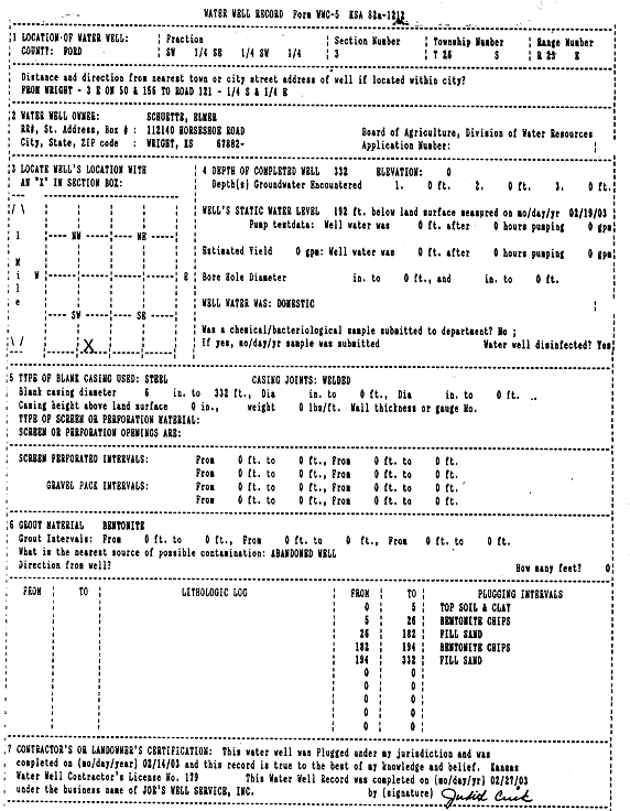
Specific Water Well Detail |
|
|
| Location Info | |||
| Owner: Schuette, Elmer | Status: Plugged | ||
| Location: T26S, R23W, Sec. 3, SW SE SW | County: Ford | ||
| Directions: from Wright: 3 mi E on 50 and 156 to Rd 121, .25 mi S, .25 mi E | |||
| Latitude: 37.8084149 | Longitude: -99.8267717 | Datum NAD 27 | |
| Latitude: 37.8084344 | Longitude: -99.8271782 | Datum NAD 83 | |
| Longitude and latitude calculated by Survey from township-range-section-quarter calls. Only good to within the quarter call accuracy. | |||
| View well on interactive map | |||
| General Info | ||
| Well Depth: 332 ft. | Elevation: ft. | |
| Static Water Level: 192 ft. | Est. Yield: gpm. | |
| Comp. Date: 14-Feb-2003 | Well Use: Domestic | |
| DWR Applic. #: | Other ID: | |
| Driller Info | ||
| Driller: Joe L. Crick, Joe's Well Service, Inc. | License #: 179 | |
| Scanned Form | View scan |
| Casing Info | ||
|
Casing Type:
Diam: in. Casing height above land surface: in | ||
| Grout Info | ||
| Grout used: | From: to ft | |
| Source of Possible Contamination | ||
| Source: | ||
| Direction from well: | Distance: ft | |