|
|
|
Specific Water Well Detail |
|
|
| Location Info | |||
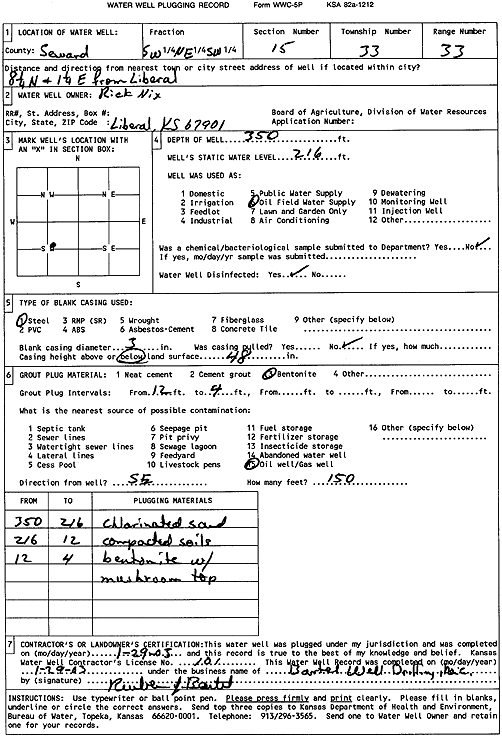
| Owner: Nix, Rich | Status: Plugged | ||
| Location: T33S, R33W, Sec. 15, SW NE SW | County: Seward | ||
| Directions: from Liberal: 8.25 mi N, 1.25 mi E | |||
| Latitude: 37.1745367 | Longitude: -100.8988176 | Datum NAD 27 | |
| Latitude: 37.1745602 | Longitude: -100.8992582 | Datum NAD 83 | |
| Longitude and latitude calculated by Survey from township-range-section-quarter calls. Only good to within the quarter call accuracy. | |||
| View well on interactive map | |||
| General Info | ||
| Well Depth: 350 ft. | Elevation: ft. | |
| Static Water Level: 216 ft. | Est. Yield: gpm. | |
| Comp. Date: 29-Jan-2003 | Well Use: Oil Field Water Supply | |
| DWR Applic. #: | Other ID: | |
| Driller Info | ||
| Driller: Bartel Well Drilling, Inc. | License #: 101 | |
| Scanned Form | View scan |
| Casing Info | ||
|
Casing Type:
Diam: in. Casing height above land surface: in | ||
| Grout Info | ||
| Grout used: | From: to ft | |
| Source of Possible Contamination | ||
| Source: | ||
| Direction from well: | Distance: ft | |