|
|
|
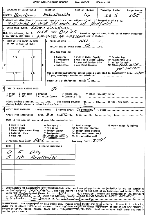
Specific Water Well Detail |
|
|
| Location Info | |||
| Owner: Henderson, Lance | Status: Plugged | ||
| Location: T25S, R23E, Sec. 16, NW NE NW | County: Bourbon | ||
| Directions: from Redfield: 2.5 mi N, .75 mi W | |||
| Latitude: 37.8766181 | Longitude: -94.8907522 | Datum NAD 27 | |
| Latitude: 37.8766571 | Longitude: -94.8909982 | Datum NAD 83 | |
| Longitude and latitude calculated by Survey from township-range-section-quarter calls. Only good to within the quarter call accuracy. | |||
| View well on interactive map | |||
| General Info | ||
| Well Depth: 100 ft. | Elevation: ft. | |
| Static Water Level: ft. | Est. Yield: gpm. | |
| Comp. Date: 06-Dec-2002 | Well Use: Test hole/well | |
| DWR Applic. #: | Other ID: | |
| Driller Info | ||
| Driller: Jesse Yoakum Well Drilling | License #: 595 | |
| Scanned Form | View scan |
| Casing Info | ||
|
Casing Type:
Diam: in. Casing height above land surface: in | ||
| Grout Info | ||
| Grout used: | From: to ft | |
| Source of Possible Contamination | ||
| Source: | ||
| Direction from well: | Distance: ft | |