|
|
|
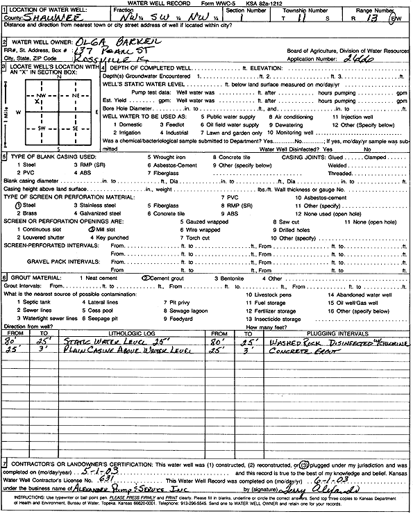
Specific Water Well Detail |
|
|
| Location Info | |||
| Owner: Barker, Olga | Status: Plugged | ||
| Location: T11S, R13E, Sec. 1, NW SW NW | County: Shawnee | ||
| Directions: | |||
| Latitude: 39.1254894 | Longitude: -95.9267362 | Datum NAD 27 | |
| Latitude: 39.1254882 | Longitude: -95.9270029 | Datum NAD 83 | |
| Longitude and latitude calculated by Survey from township-range-section-quarter calls. Only good to within the quarter call accuracy. | |||
| View well on interactive map | |||
| General Info | ||
| Well Depth: ft. | Elevation: ft. | |
| Static Water Level: ft. | Est. Yield: gpm. | |
| Comp. Date: 01-May-2003 | Well Use: (unstated)/abandoned | |
| DWR Applic. #: 2666 | Other ID: | |
| Links | |
| View info from Wizard Water Level Data base... | |
| View info from WIMAS Water Right Data base... | |
| Driller Info | ||
| Driller: Terry Alexander Pump & Service | License #: 631 | |
| Scanned Form | View scan |
| Casing Info | ||
|
Casing Type:
Diam: in. Casing height above land surface: in | ||
| Grout Info | ||
| Grout used: | From: to ft | |
| Source of Possible Contamination | ||
| Source: | ||
| Direction from well: | Distance: ft | |