|
|
|
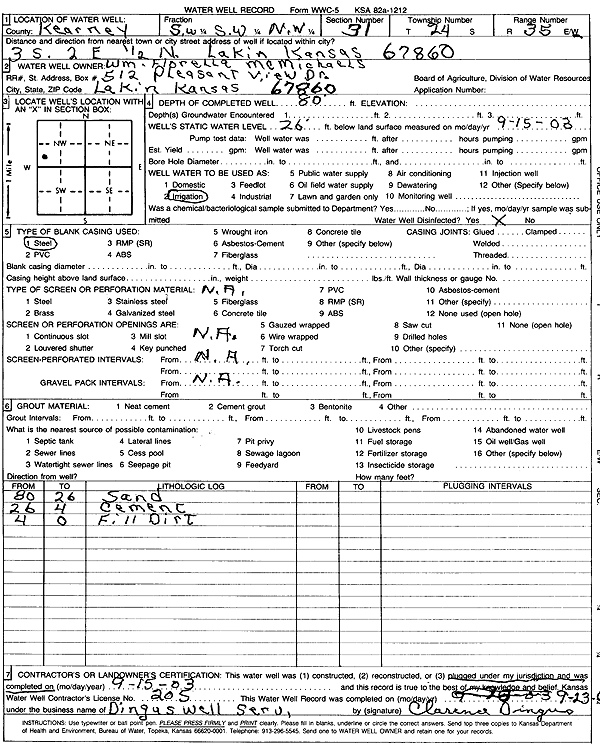
Specific Water Well Detail |
|
|
| Location Info | |||
| Owner: McMichael, William and Fiorella | Status: Plugged | ||
| Location: T24S, R35W, Sec. 31, SW SW NW | County: Kearny | ||
| Directions: from Lakin: 3 mi S, 2 mi E, .5 mi N | |||
| Latitude: 37.9235789 | Longitude: -101.2114652 | Datum NAD 27 | |
| Latitude: 37.9235991 | Longitude: -101.2119127 | Datum NAD 83 | |
| Longitude and latitude calculated by Survey from township-range-section-quarter calls. Only good to within the quarter call accuracy. | |||
| View well on interactive map | |||
| General Info | ||
| Well Depth: 80 ft. | Elevation: ft. | |
| Static Water Level: 26 ft. | Est. Yield: gpm. | |
| Comp. Date: 15-Sep-2003 | Well Use: Irrigation | |
| DWR Applic. #: | Other ID: | |
| Links | |
| View info from Wizard Water Level Data base... | |
| View info from WIMAS Water Right Data base... | |
| Driller Info | ||
| Driller: Clarence L. Dingus Well Service & Trenching | License #: 205 | |
| Scanned Form | View scan |
| Casing Info | ||
|
Casing Type:
Diam: in. Casing height above land surface: in | ||
| Grout Info | ||
| Grout used: | From: to ft | |
| Source of Possible Contamination | ||
| Source: | ||
| Direction from well: | Distance: ft | |