|
|
|
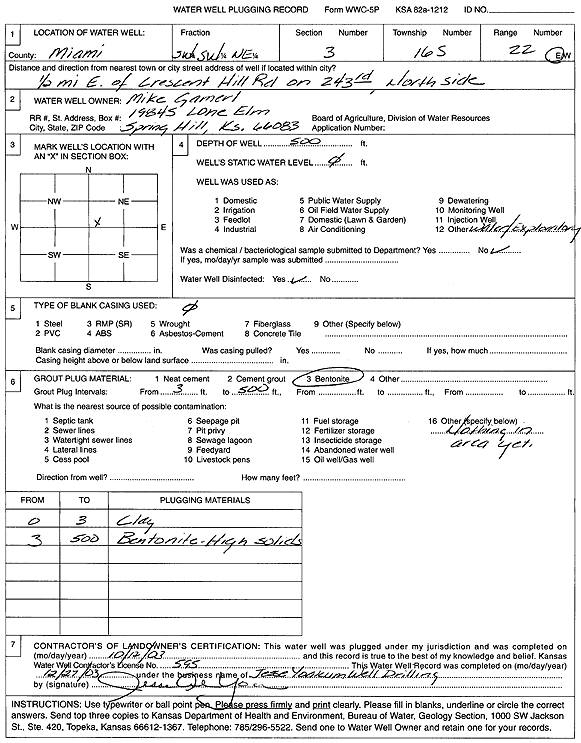
Specific Water Well Detail |
|
|
| Location Info | |||
| Owner: Gamerl, Mike | Status: Plugged | ||
| Location: T16S, R22E, Sec. 3, SW SW NE | County: Miami | ||
| Directions: from Crescent Hill Rd: .5 mi E on 243rd, N side | |||
| Latitude: 38.6883613 | Longitude: -94.9641851 | Datum NAD 27 | |
| Latitude: 38.6883713 | Longitude: -94.9644283 | Datum NAD 83 | |
| Longitude and latitude calculated by Survey from township-range-section-quarter calls. Only good to within the quarter call accuracy. | |||
| View well on interactive map | |||
| General Info | ||
| Well Depth: 500 ft. | Elevation: ft. | |
| Static Water Level: ft. | Est. Yield: gpm. | |
| Comp. Date: 12-Oct-2003 | Well Use: Test hole/well | |
| DWR Applic. #: | Other ID: | |
| Driller Info | ||
| Driller: Jesse Yoakum Well Drilling | License #: 595 | |
| Scanned Form | View scan |
| Casing Info | ||
|
Casing Type:
Diam: in. Casing height above land surface: in | ||
| Grout Info | ||
| Grout used: | From: to ft | |
| Source of Possible Contamination | ||
| Source: | ||
| Direction from well: | Distance: ft | |