|
|
|
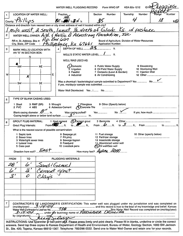
Specific Water Well Detail |
|
|
| Location Info | |||
| Owner: A.W. and Nellie B. Armstrong Foundation, Inc | Status: Plugged | ||
| Location: T4S, R18W, Sec. 35, NE NE SW | County: Phillips | ||
| Directions: from Glade: 1 mi W, 2 mi S, 1 mi W, .5 mi N, pasture | |||
| Latitude: 39.6606977 | Longitude: -99.3194327 | Datum NAD 27 | |
| Latitude: 39.6607074 | Longitude: -99.3198075 | Datum NAD 83 | |
| Longitude and latitude calculated by Survey from township-range-section-quarter calls. Only good to within the quarter call accuracy. | |||
| View well on interactive map | |||
| General Info | ||
| Well Depth: 28 ft. | Elevation: ft. | |
| Static Water Level: 1 ft. | Est. Yield: gpm. | |
| Comp. Date: 14-Mar-2004 | Well Use: Domestic | |
| DWR Applic. #: | Other ID: | |
| Driller Info | ||
| Driller: Redinger Well Service | License #: 738 | |
| Scanned Form | View scan |
| Casing Info | ||
|
Casing Type:
Diam: in. Casing height above land surface: in | ||
| Grout Info | ||
| Grout used: | From: to ft | |
| Source of Possible Contamination | ||
| Source: | ||
| Direction from well: | Distance: ft | |