|
|
|
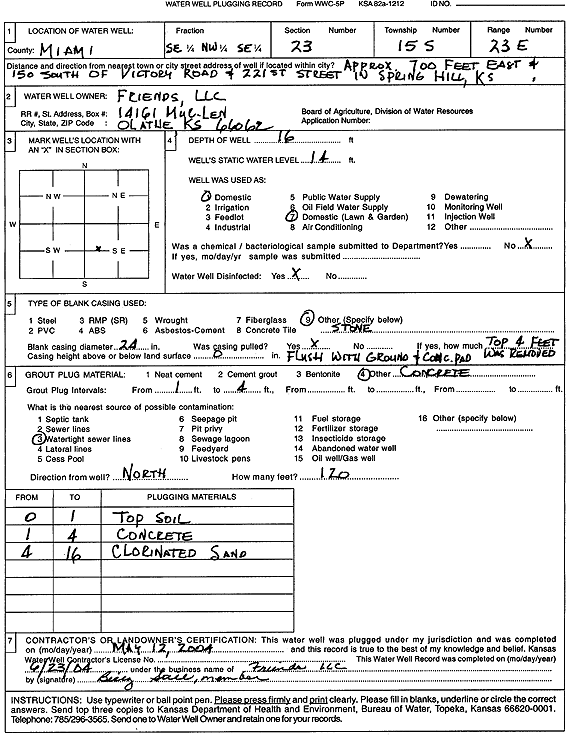
Specific Water Well Detail |
|
|
| Location Info | |||
| Owner: Friends, LLC | Status: Plugged | ||
| Location: T15S, R23E, Sec. 23, SE NW SE | County: Miami | ||
| Directions: from Victory Rd and 221st St: 700 feet E, 150 feet S, Spring Hill | |||
| Latitude: 38.728276 | Longitude: -94.8214414 | Datum NAD 27 | |
| Latitude: 38.7282854 | Longitude: -94.82168 | Datum NAD 83 | |
| Longitude and latitude calculated by Survey from township-range-section-quarter calls. Only good to within the quarter call accuracy. | |||
| View well on interactive map | |||
| General Info | ||
| Well Depth: 16 ft. | Elevation: ft. | |
| Static Water Level: 14 ft. | Est. Yield: gpm. | |
| Comp. Date: 12-May-2004 | Well Use: Domestic, Lawn and Garden | |
| DWR Applic. #: | Other ID: | |
| Driller Info | ||
| Driller: Friends, LLC | License #: | |
| Scanned Form | View scan |
| Casing Info | ||
|
Casing Type:
Diam: in. Casing height above land surface: in | ||
| Grout Info | ||
| Grout used: | From: to ft | |
| Source of Possible Contamination | ||
| Source: | ||
| Direction from well: | Distance: ft | |