|
|
|
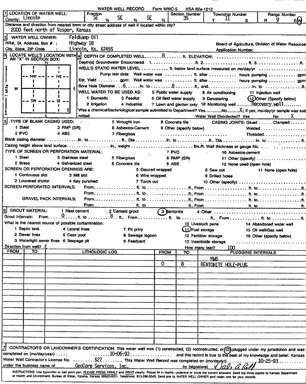
Specific Water Well Detail |
|
|
| Location Info | |||
| Owner: Feldkamp Oil | Status: Plugged | ||
| Location: T11S, R9W, Sec. 35, SE SE SE | County: Lincoln | ||
| Directions: from Vesper, 2000 feet N | |||
| Latitude: 39.0466436 | Longitude: -98.2814447 | Datum NAD 27 | |
| Latitude: 39.0466514 | Longitude: -98.2817796 | Datum NAD 83 | |
| Longitude and latitude calculated by Survey from township-range-section-quarter calls. Only good to within the quarter call accuracy. | |||
| View well on interactive map | |||
| General Info | ||
| Well Depth: 8 ft. | Elevation: ft. | |
| Static Water Level: ft. | Est. Yield: gpm. | |
| Comp. Date: 06-Oct-1993 | Well Use: Monitoring well/observation/piezometer | |
| DWR Applic. #: | Other ID: MW 6 | |
| Driller Info | ||
| Driller: GeoCore Services Inc. | License #: 527 | |
| Scanned Form | View scan |
| Casing Info | ||
|
Casing Type: PVC
Diam: 6 in. Casing height above land surface: in | ||
| Grout Info | ||
| Grout used: Bentonite | From: 0 to 8 ft
From: 0 to 0 ft From: 0 to 0 ft | |
| Source of Possible Contamination | ||
| Source: Fuel storage | ||
| Direction from well: | Distance: 0 ft | |