|
|
|
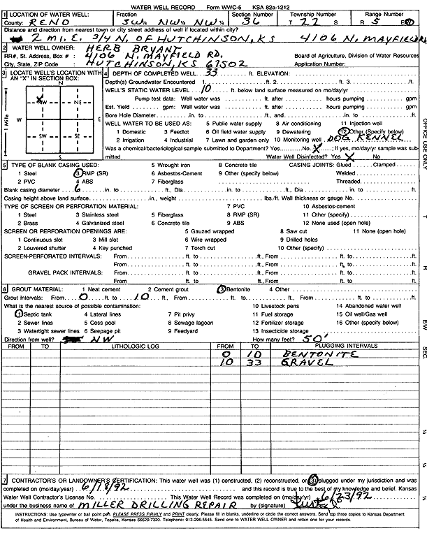
Specific Water Well Detail |
|
|
| Location Info | |||
| Owner: Bryant, Herb | Status: Plugged | ||
| Location: T22S, R5W, Sec. 36, SW NW NW | County: Reno | ||
| Directions: 4106 N Mayfield Rd, Hutchinson - from Hutchinson: 2 mi E, .75 mi N | |||
| Latitude: 38.0982968 | Longitude: -97.8286662 | Datum NAD 27 | |
| Latitude: 38.0983074 | Longitude: -97.8289935 | Datum NAD 83 | |
| Longitude and latitude calculated by Survey from township-range-section-quarter calls. Only good to within the quarter call accuracy. | |||
| View well on interactive map | |||
| General Info | ||
| Well Depth: 33 ft. | Elevation: ft. | |
| Static Water Level: 10 ft. | Est. Yield: gpm. | |
| Comp. Date: 18-Jun-1992 | Well Use: Domestic | |
| DWR Applic. #: | Other ID: | |
| Driller Info | ||
| Driller: Miller Drilling | License #: 447 | |
| Scanned Form | View scan |
| Casing Info | ||
|
Casing Type: RMP(SR)
Diam: 6 in. Casing height above land surface: in | ||
| Grout Info | ||
| Grout used: Bentonite | From: 0 to 10 ft
From: 0 to 0 ft From: 0 to 0 ft | |
| Source of Possible Contamination | ||
| Source: Septic Tank | ||
| Direction from well: | Distance: 0 ft | |