|
|
|
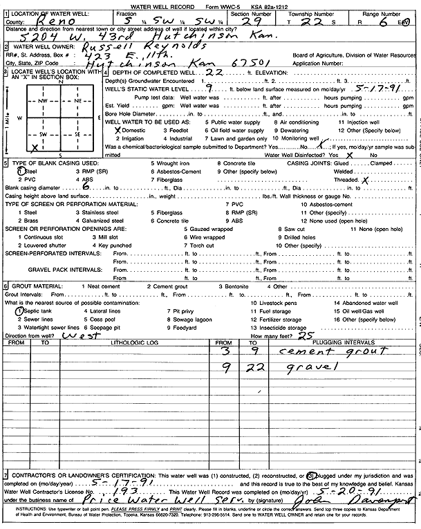
Specific Water Well Detail |
|
|
| Location Info | |||
| Owner: Reynolds, Russell | Status: Plugged | ||
| Location: T22S, R6W, Sec. 29, S2 SW SW | County: Reno | ||
| Directions: 5204 W 43rd, Hutchinson | |||
| Latitude: 38.1013395 | Longitude: -98.0121842 | Datum NAD 27 | |
| Latitude: 38.1013507 | Longitude: -98.0125162 | Datum NAD 83 | |
| Longitude and latitude calculated by Survey from township-range-section-quarter calls. Only good to within the quarter call accuracy. | |||
| View well on interactive map | |||
| General Info | ||
| Well Depth: 22 ft. | Elevation: ft. | |
| Static Water Level: 9 ft. | Est. Yield: gpm. | |
| Comp. Date: 17-May-1991 | Well Use: Domestic | |
| DWR Applic. #: | Other ID: | |
| Driller Info | ||
| Driller: Price Water Well Service | License #: 193 | |
| Scanned Form | View scan |
| Casing Info | ||
|
Casing Type: Steel
Diam: 6 in. Casing height above land surface: in | ||
| Grout Info | ||
| Grout used: Cement grout | From: 3 to 9 ft
From: 0 to 0 ft From: 0 to 0 ft | |
| Source of Possible Contamination | ||
| Source: Septic Tank | ||
| Direction from well: | Distance: 0 ft | |