|
|
|
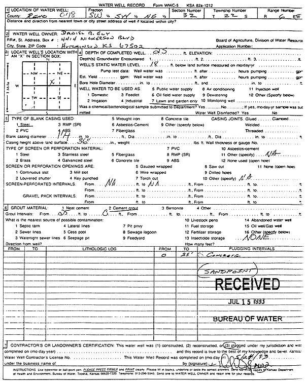
Specific Water Well Detail |
|
|
| Location Info | |||
| Owner: Ely, Daniel B. | Status: Plugged | ||
| Location: T22S, R6W, Sec. 32, SW SW NE | County: Reno | ||
| Directions: | |||
| Latitude: 38.0940074 | Longitude: -98.0042168 | Datum NAD 27 | |
| Latitude: 38.0940186 | Longitude: -98.0045485 | Datum NAD 83 | |
| Longitude and latitude calculated by Survey from township-range-section-quarter calls. Only good to within the quarter call accuracy. | |||
| View well on interactive map | |||
| General Info | ||
| Well Depth: 25 ft. | Elevation: ft. | |
| Static Water Level: 18 ft. | Est. Yield: gpm. | |
| Comp. Date: 24-May-1993 | Well Use: Domestic, Lawn and Garden | |
| DWR Applic. #: | Other ID: | |
| Driller Info | ||
| Driller: well owner | License #: | |
| Scanned Form | View scan |
| Casing Info | ||
|
Casing Type: Steel
Diam: 1 in. Casing height above land surface: in | ||
| Grout Info | ||
| Grout used: Cement grout | From: 0 to 25 ft
From: 0 to 0 ft From: 0 to 0 ft | |
| Source of Possible Contamination | ||
| Source: OTHER | ||
| Direction from well: | Distance: 0 ft | |