|
|
|
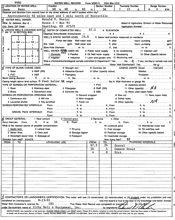
Specific Water Well Detail |
|
|
| Location Info | |||
| Owner: Mosier, Ronald V. | Status: Plugged | ||
| Location: T22S, R9W, Sec. 36, NE NE SE | County: Reno | ||
| Directions: from Huntsville: 4.25 mi E, 1 mi N | |||
| Latitude: 38.0926452 | Longitude: -98.2529238 | Datum NAD 27 | |
| Latitude: 38.0926578 | Longitude: -98.253266 | Datum NAD 83 | |
| Longitude and latitude calculated by Survey from township-range-section-quarter calls. Only good to within the quarter call accuracy. | |||
| View well on interactive map | |||
| General Info | ||
| Well Depth: 67.5 ft. | Elevation: ft. | |
| Static Water Level: 24.6 ft. | Est. Yield: gpm. | |
| Comp. Date: 13-Aug-1991 | Well Use: Domestic | |
| DWR Applic. #: | Other ID: | |
| Driller Info | ||
| Driller: Clarke Well and Equipment, Inc. | License #: 185 | |
| Scanned Form | View scan |
| Casing Info | ||
|
Casing Type: PVC
Diam: 6 in. Casing height above land surface: in | ||
| Grout Info | ||
| Grout used: Cement grout | From: 4 to 26 ft
From: 0 to 0 ft From: 0 to 0 ft | |
| Source of Possible Contamination | ||
| Source: Septic Tank | ||
| Direction from well: | Distance: 0 ft | |