|
|
|
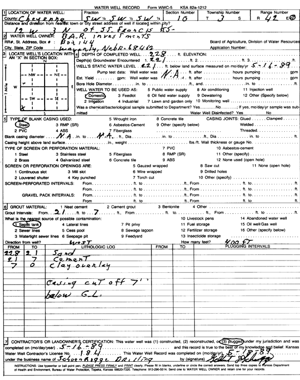
Specific Water Well Detail |
|
|
| Location Info | |||
| Owner: B. A. R. Investments | Status: Plugged | ||
| Location: T3S, R42W, Sec. 10, SW SW SW | County: Cheyenne | ||
| Directions: from St. Francis, 12 mi W and 3 mi N | |||
| Latitude: 39.8007092 | Longitude: -102.0291975 | Datum NAD 27 | |
| Latitude: 39.8007017 | Longitude: -102.0296598 | Datum NAD 83 | |
| Longitude and latitude calculated by Survey from township-range-section-quarter calls. Only good to within the quarter call accuracy. | |||
| View well on interactive map | |||
| General Info | ||
| Well Depth: 228 ft. | Elevation: ft. | |
| Static Water Level: 221 ft. | Est. Yield: gpm. | |
| Comp. Date: 16-May-1989 | Well Use: Domestic | |
| DWR Applic. #: | Other ID: | |
| Driller Info | ||
| Driller: Schoenrogge Drilling, Inc. | License #: 184 | |
| Scanned Form | View scan |
| Casing Info | ||
|
Casing Type: Steel
Diam: 0 in. Casing height above land surface: in | ||
| Grout Info | ||
| Grout used: | From: 7 to 21 ft
From: 0 to 0 ft From: 0 to 0 ft | |
| Source of Possible Contamination | ||
| Source: Septic Tank | ||
| Direction from well: | Distance: 0 ft | |