|
|
|
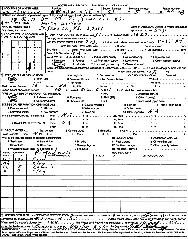
Specific Water Well Detail |
|
|
| Location Info | |||
| Owner: Wolter, Henry | Status: Plugged | ||
| Location: T5S, R40W, Sec. 21, NW SW SE | County: Cheyenne | ||
| Directions: from St. Francis, 10 mi S | |||
| Latitude: 39.6001577 | Longitude: -101.8147413 | Datum NAD 27 | |
| Latitude: 39.6001525 | Longitude: -101.8151947 | Datum NAD 83 | |
| Longitude and latitude calculated by Survey from township-range-section-quarter calls. Only good to within the quarter call accuracy. | |||
| View well on interactive map | |||
| General Info | ||
| Well Depth: 331 ft. | Elevation: 3620 ft. | |
| Static Water Level: 212 ft. | Est. Yield: gpm. | |
| Comp. Date: 04-Jun-1987 | Well Use: Irrigation | |
| DWR Applic. #: 6733 | Other ID: | |
| Links | |
| View info from Wizard Water Level Data base... | |
| View info from WIMAS Water Right Data base... | |
| Driller Info | ||
| Driller: Schoenrogge Drilling, Inc. | License #: 184 | |
| Scanned Form | View scan |
| Casing Info | ||
|
Casing Type: Steel
Diam: 16 in. Casing height above land surface: in | ||
| Grout Info | ||
| Grout used: | From: 0 to 0 ft
From: 0 to 0 ft From: 0 to 0 ft | |
| Source of Possible Contamination | ||
| Source: | ||
| Direction from well: | Distance: 0 ft | |